|
|
  |
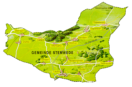
Stemwede Map Center
|
|
|
So, you've found Stemwede using Mapquest or another online mapping service. Now how about some real maps. With the exception of the current map, high resolution maps reside here to help you find those small little localities that you won't find on any other maps.
 |
||||||
 |
Stemwede's
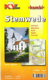
Current Map. This map contains the "new" street names that have been given to all of the streets in the Stemwede area. It can be ordered from www.amazon.de, ISBN: 3896412434. This one was printed in 2005 and runs about $5 (plus shipping). |
|||||
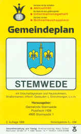 |
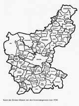
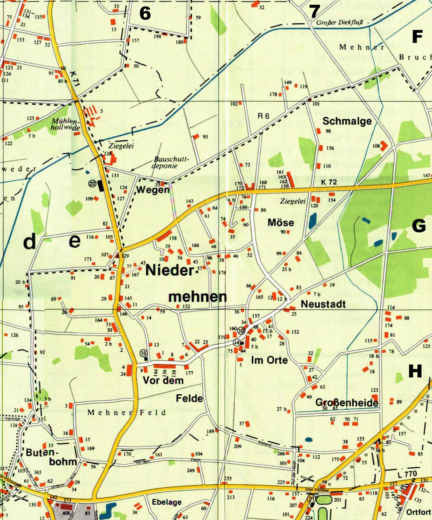
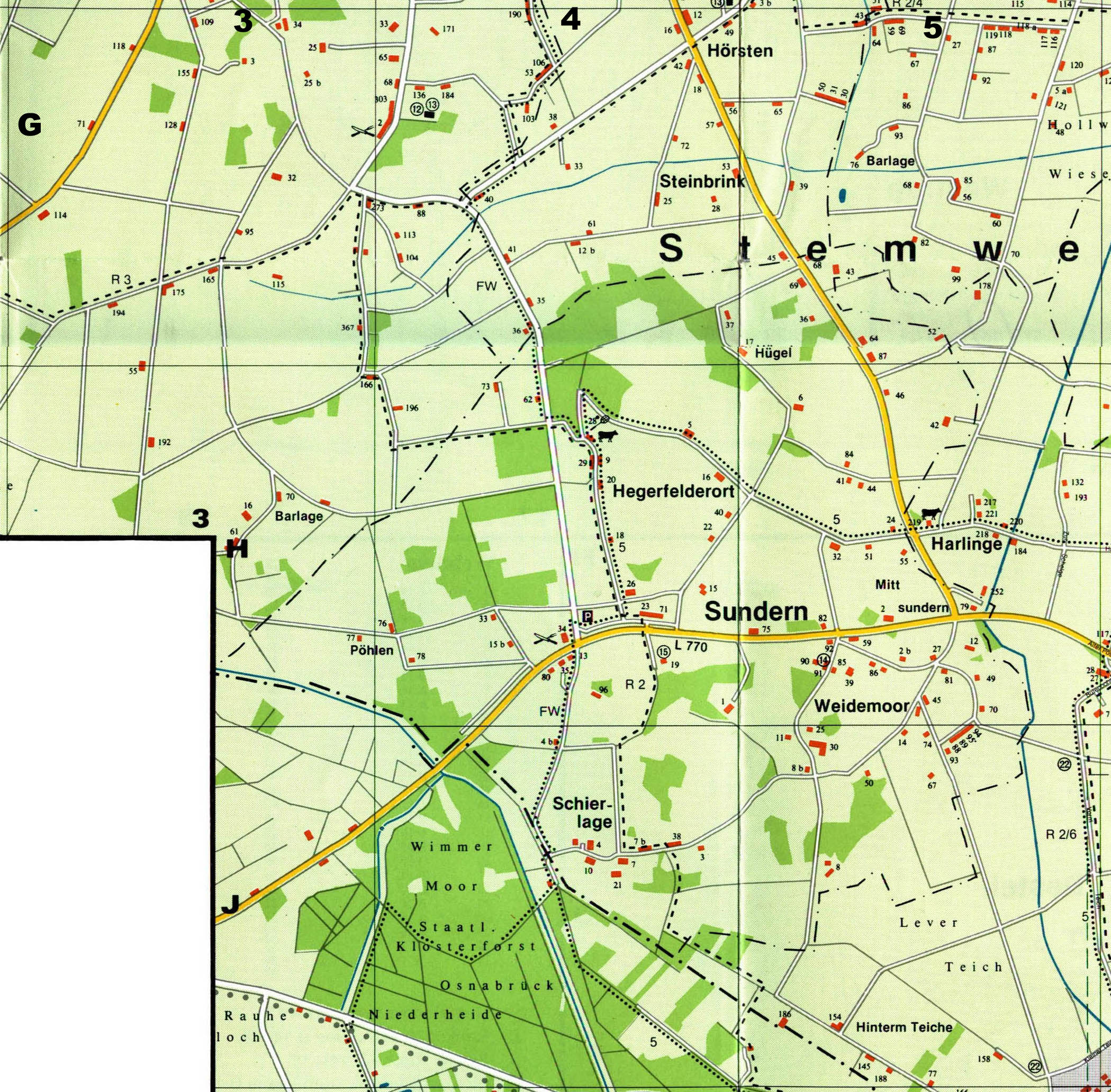
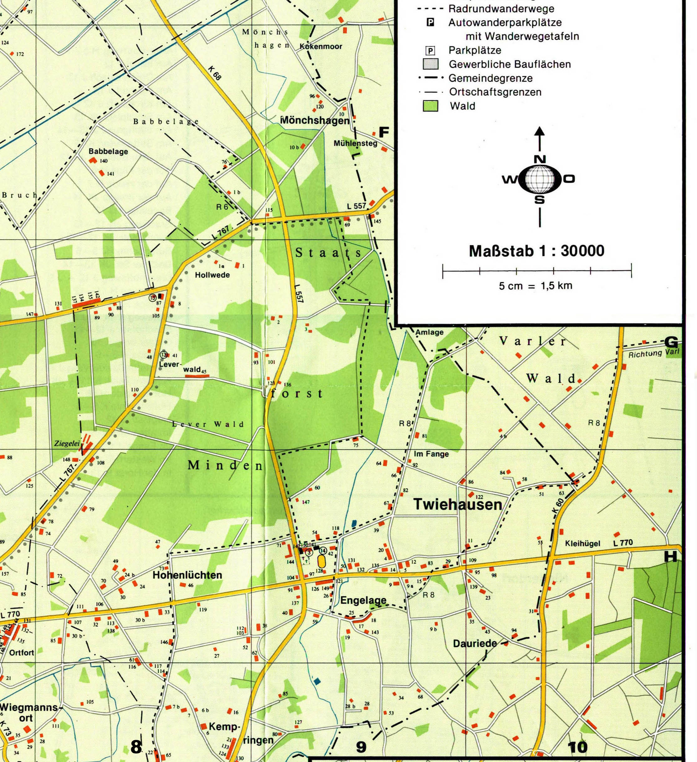
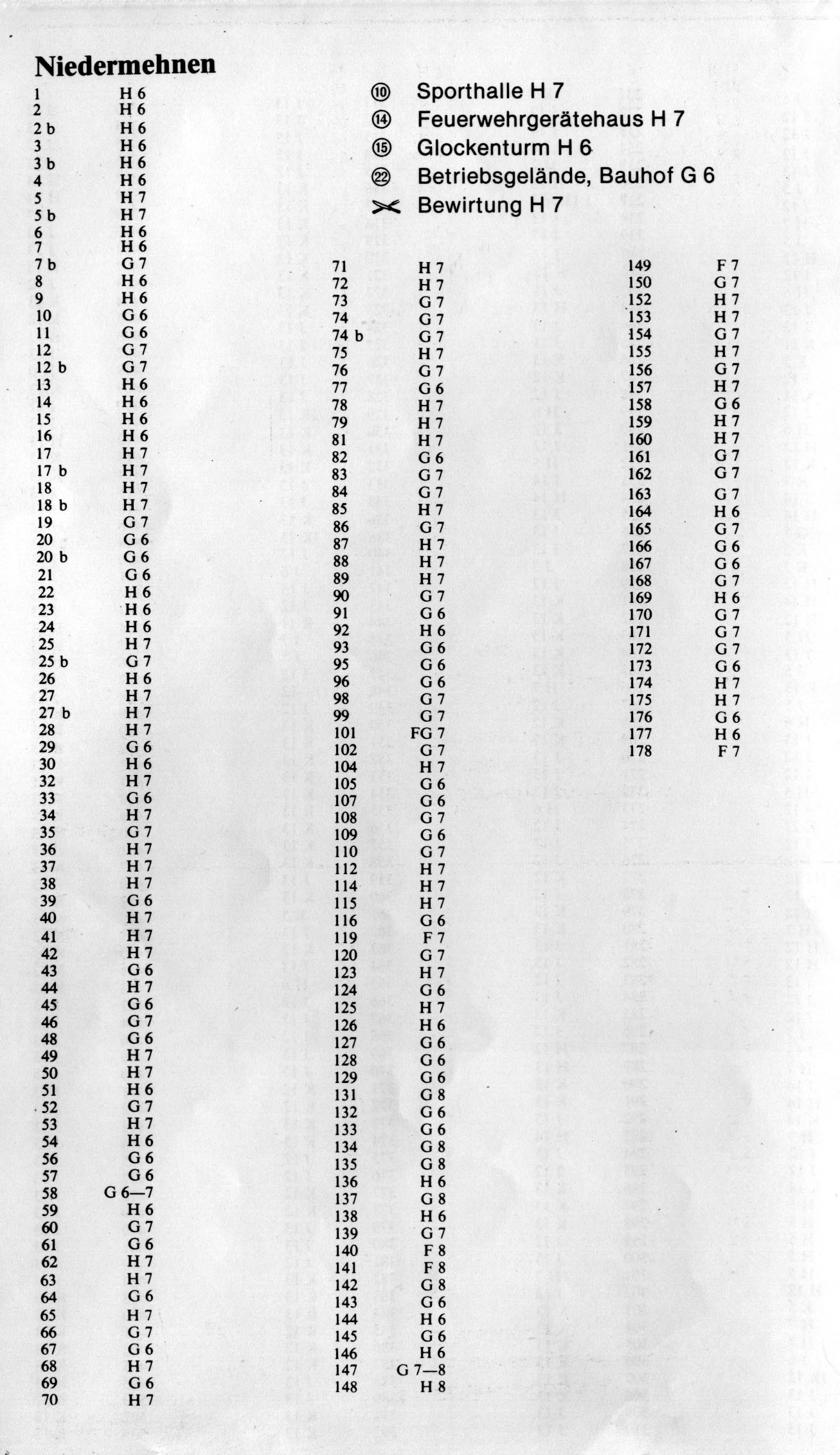
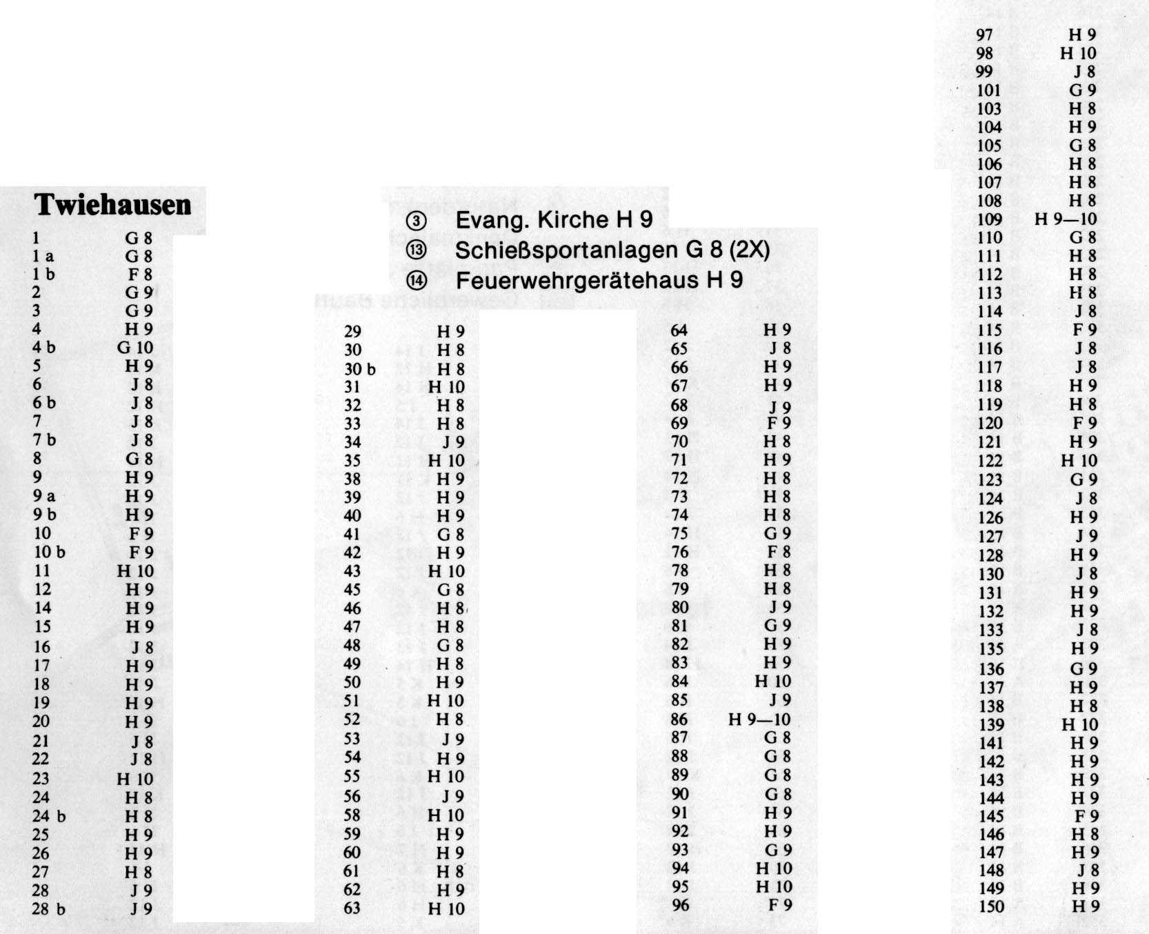
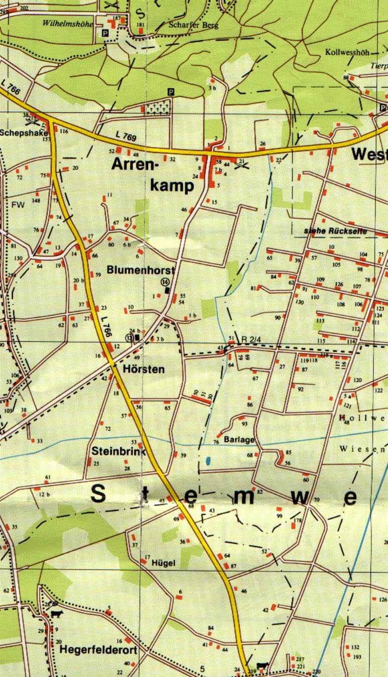
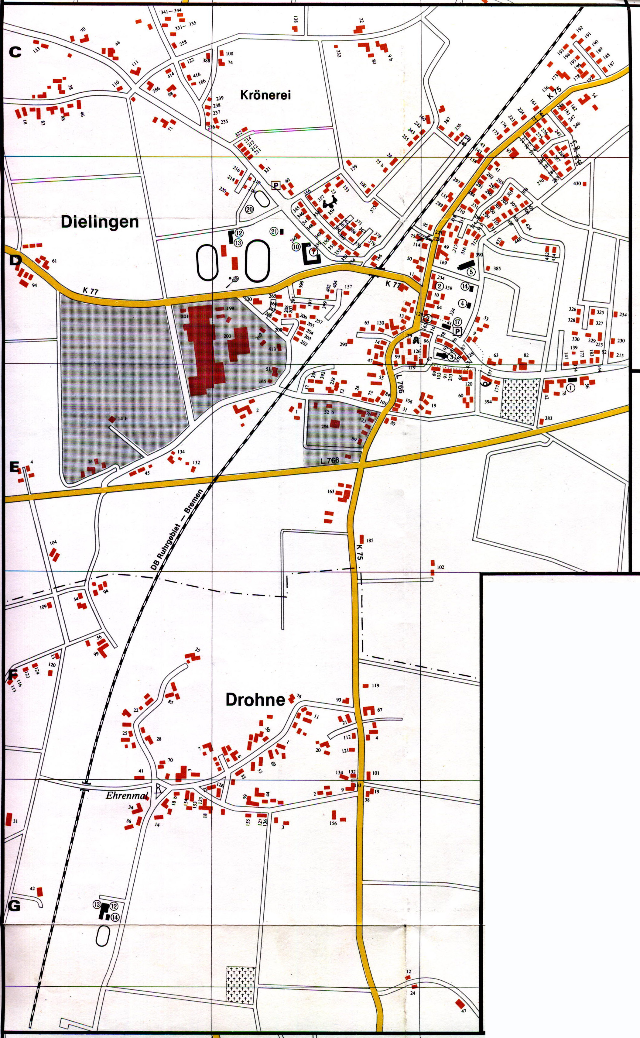
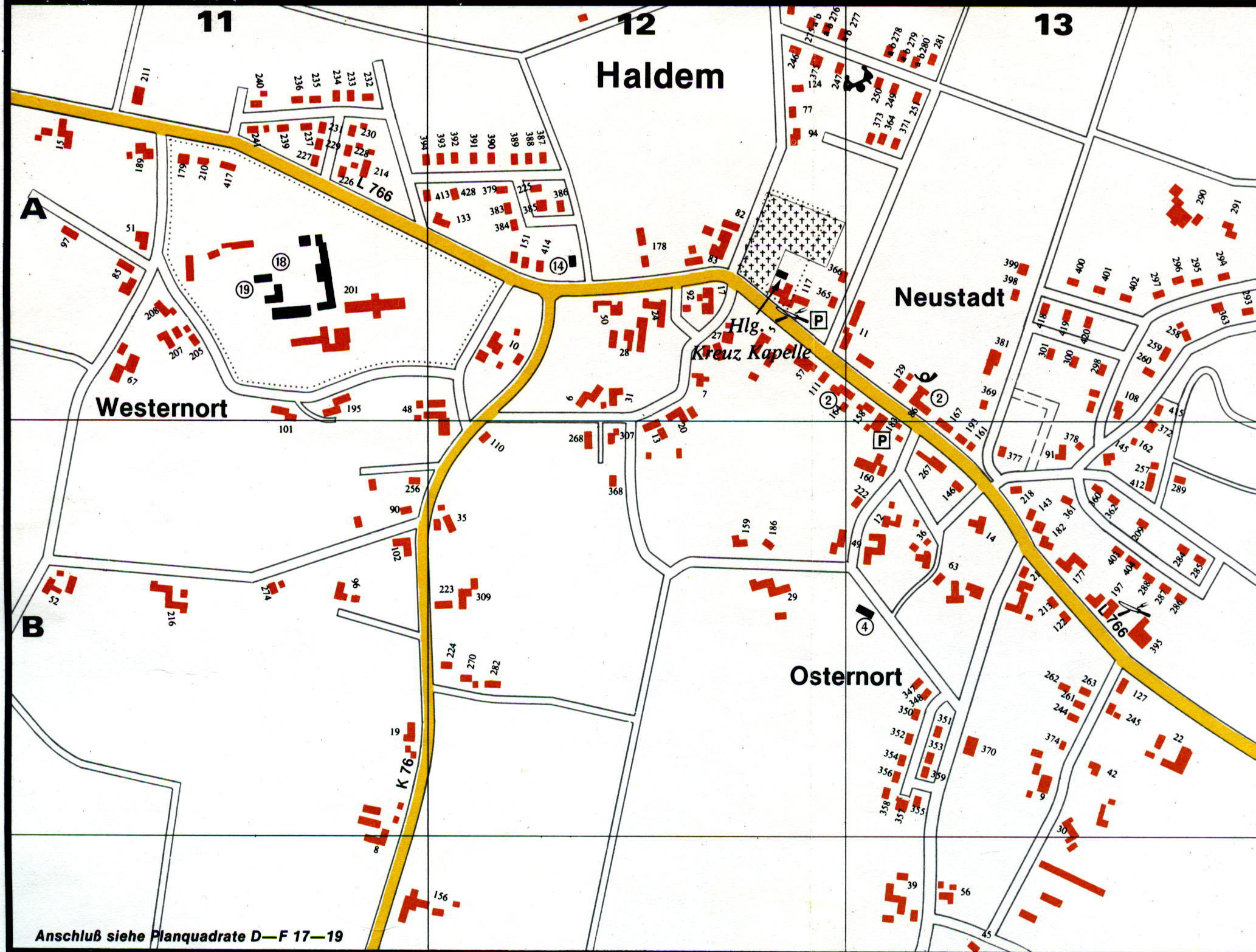
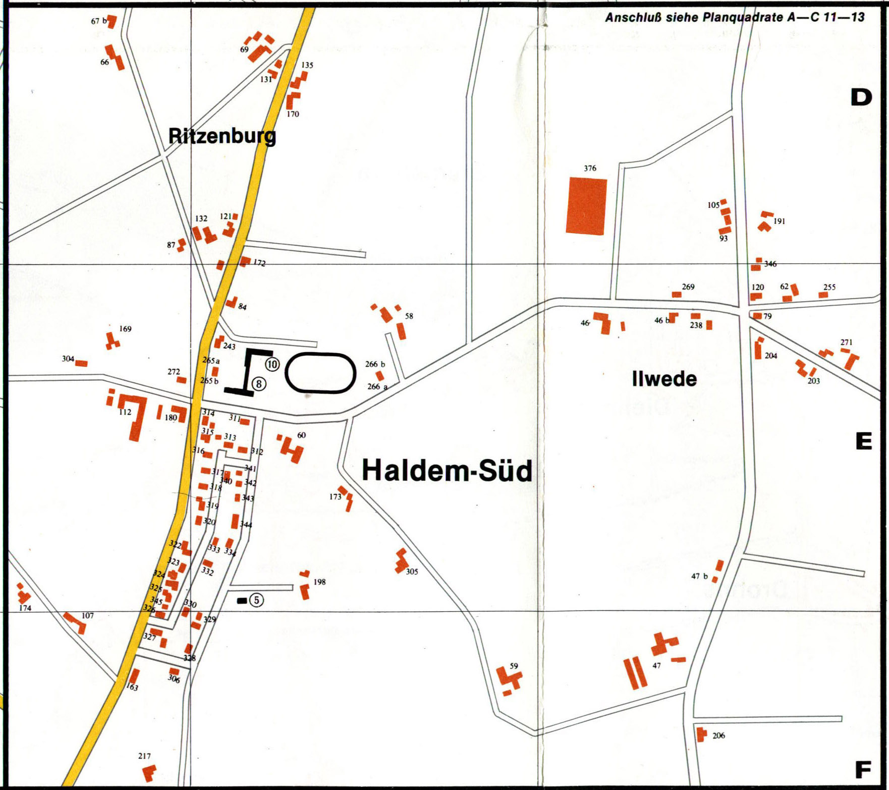
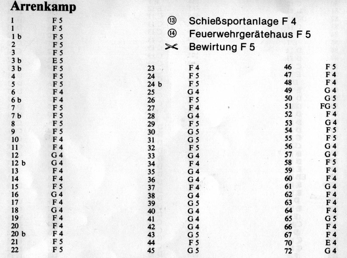
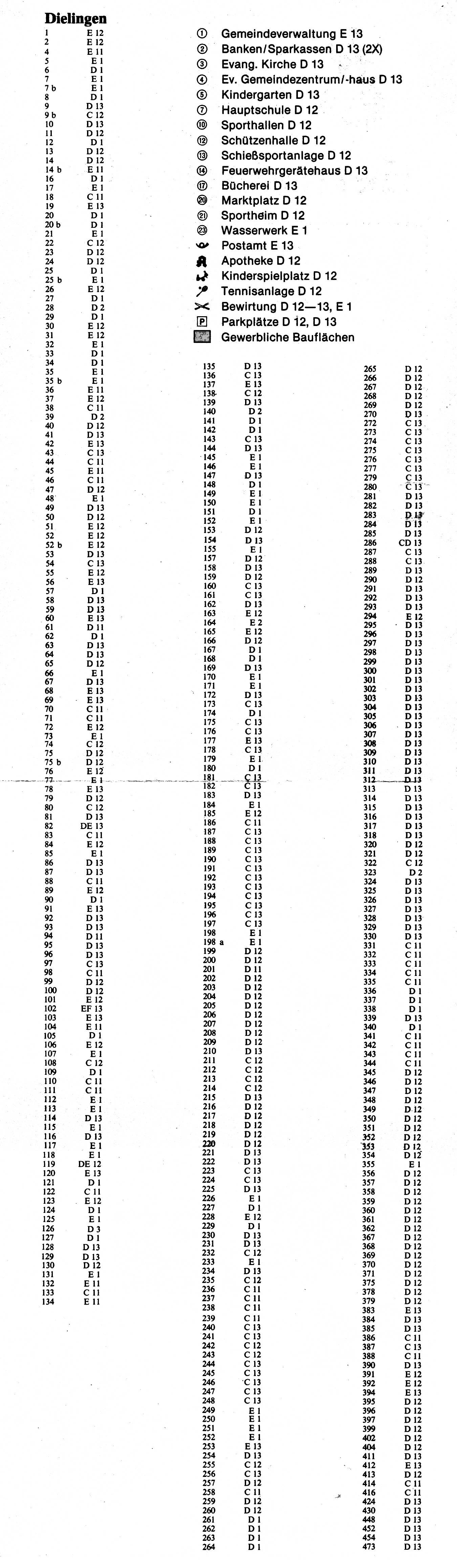
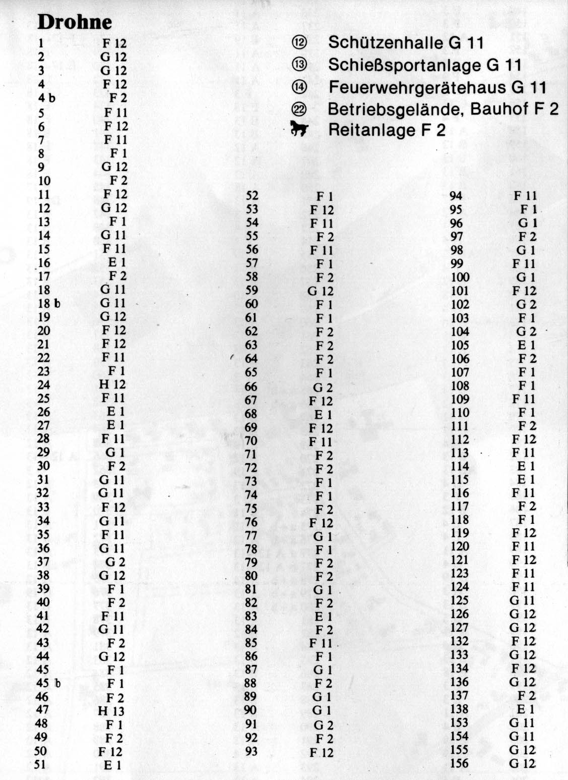
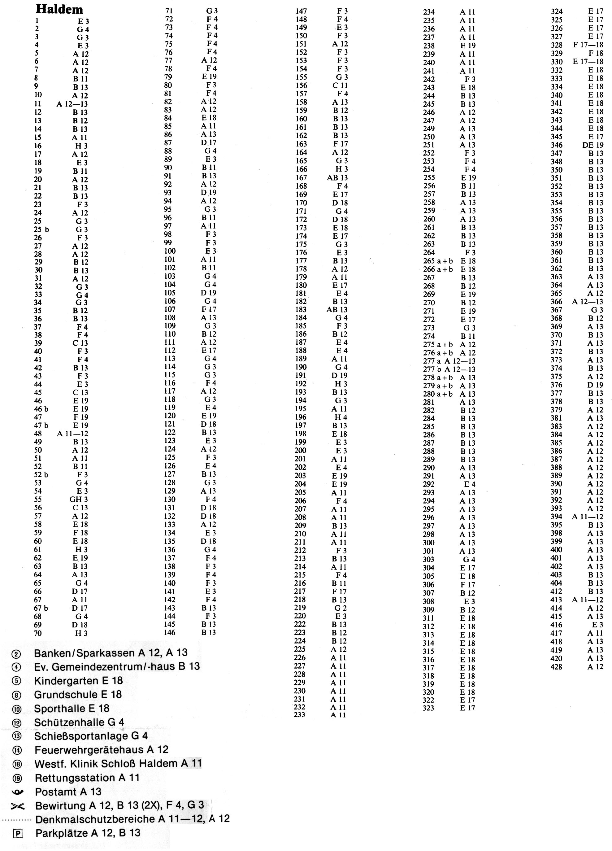
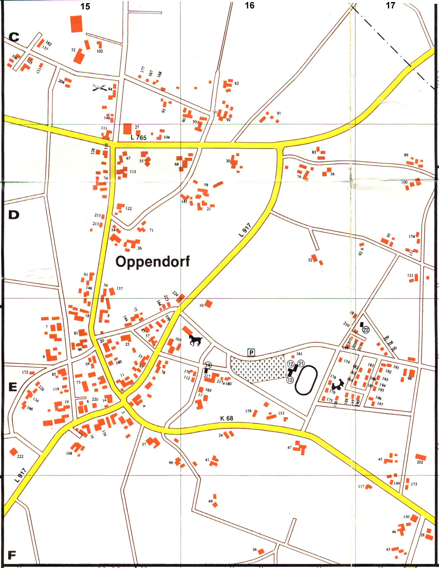
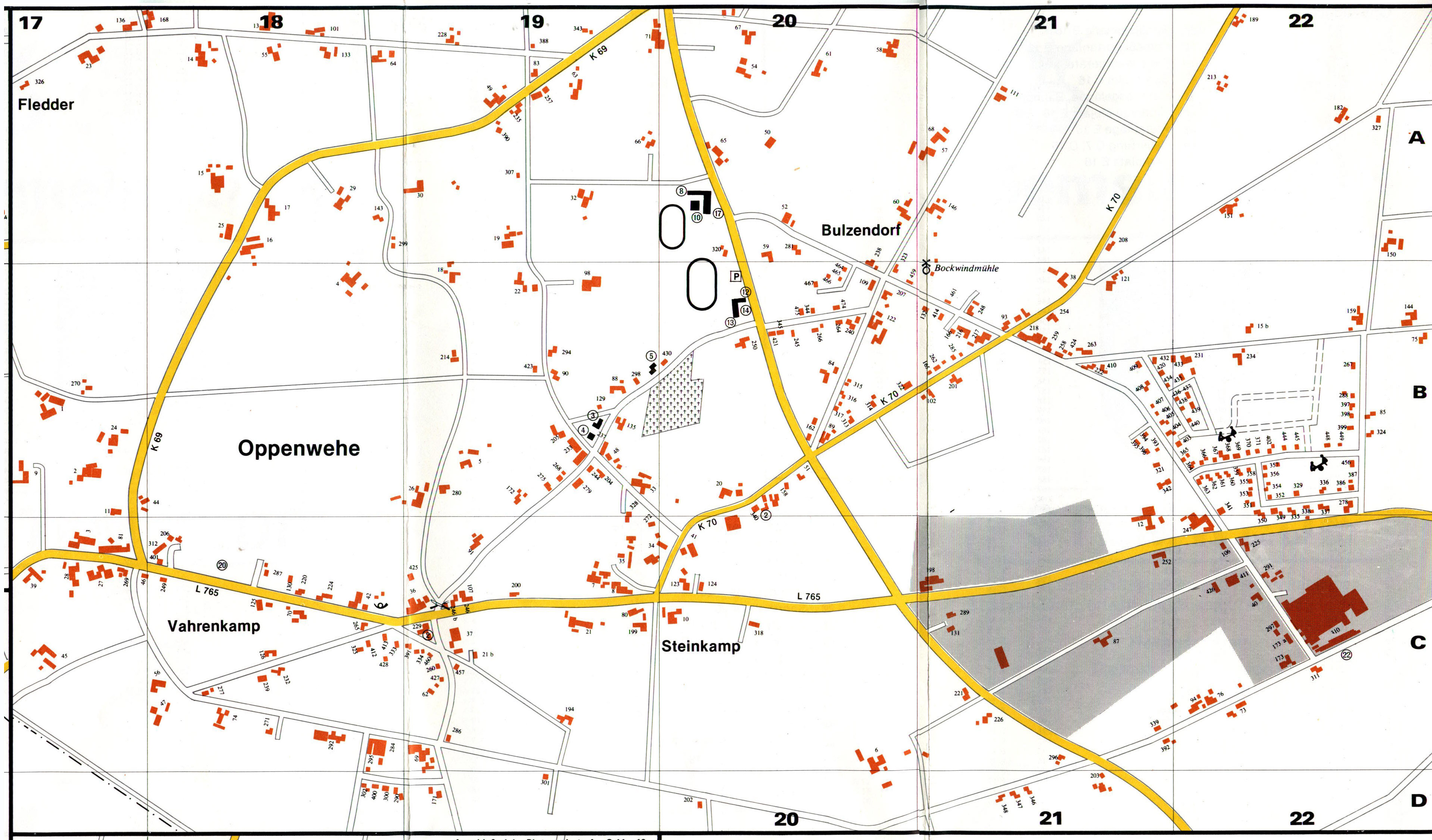
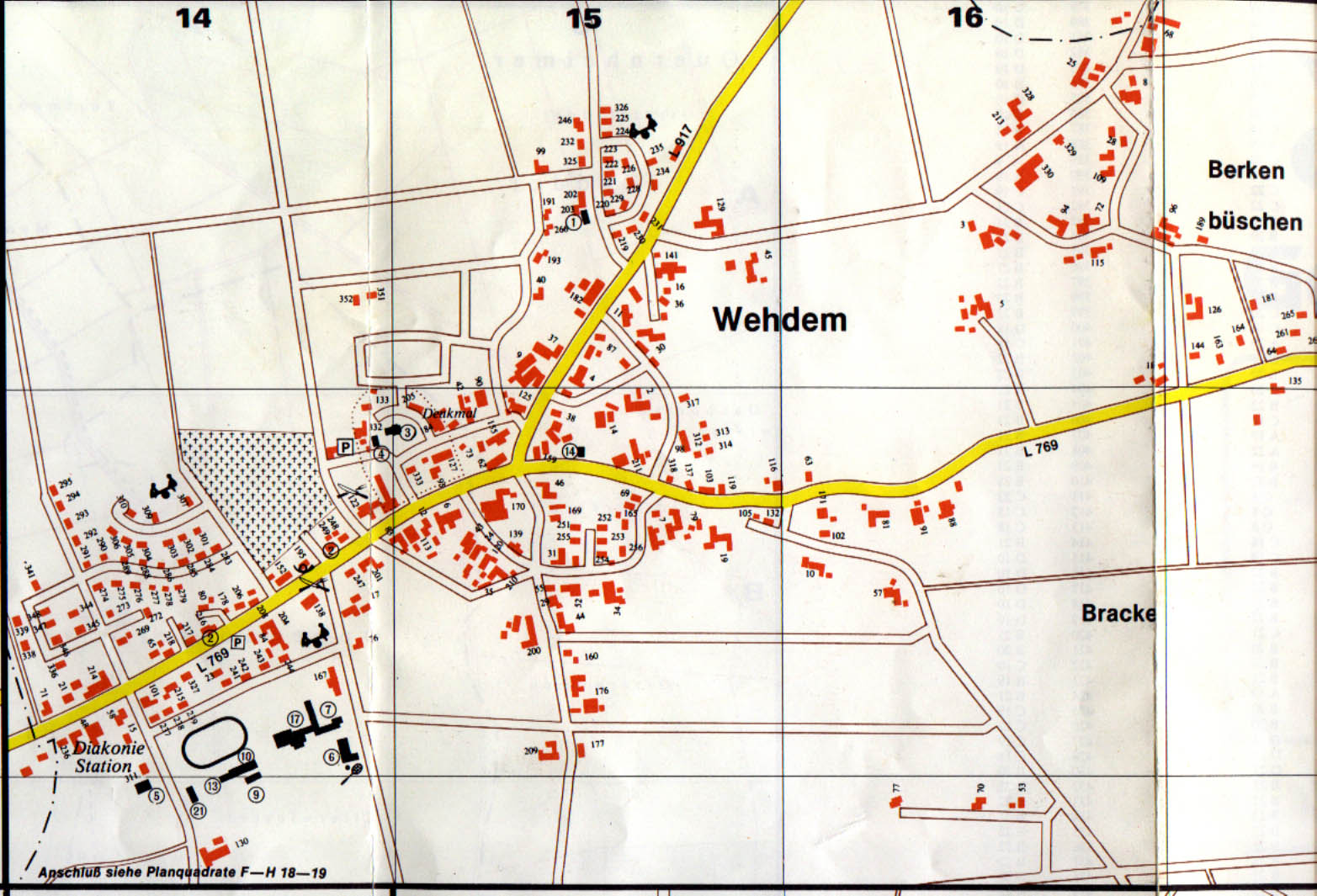
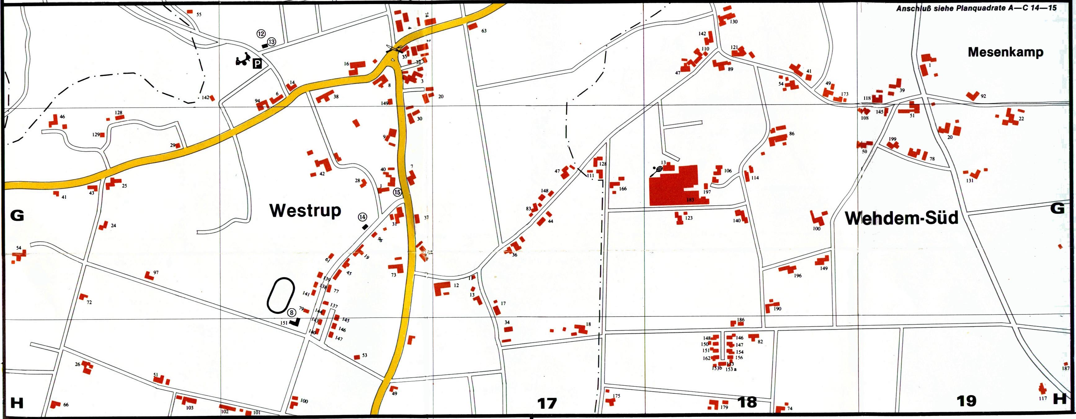
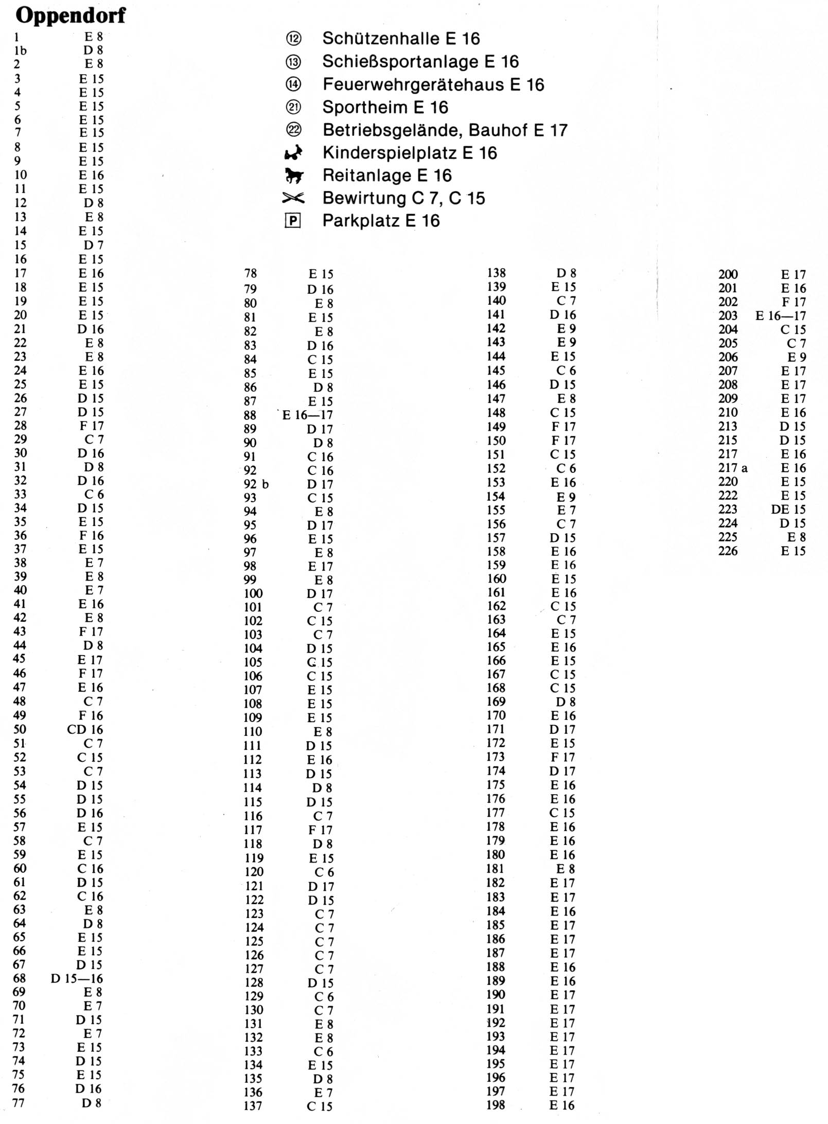
This edition of Stemwede's Map was printed in 1988. As recent as it is, it is now obsolete, at least for people trying to locate where someone's current address is. For genealogy researchers, however, it is a gem. The map is a close enough look to reveal where each house is located, including it's "homestead number". These are the old addresses, which were replaced in the mid 1990's with sequential numbering and street names. The homestead numbers go back to the 1700s and are sequential, chronologically as each household was established. So now you can locate that Oppendorf Nr. 14 is located at a main crossroads in town and their neighbors are Oppendorf Nr. 5 & Nr. 220. Overview Stemwede Map. This is very large (8 MB). Right-click on link to download. I don't recommend simply clicking the link to open the file in your browser. It's too large to be able to see the whole picture and you will be lost trying to figure out where you are. Instead open it with the Windows XP preview viewer or a imaging program that allows you to zoom in and out. Each map for the villages also has an index for it, to help you locate the house numbers and landmarks in the town. The detail maps below do not contain all of the homesteads for each village. Some may be noted only of the overview map. | |||||
| Levern Parish: | Dielingen Parish: | |||||
|
Destel Levern Niedermehnen Sundern Twiehausen |
Index Index Index Index Index |
Arrenkamp Dielingen & Drohne Haldem Haldem South area |
Index Dielingen Index Drohne Index Index |
Oppendorf Oppenwehe Wehdem Westrup & South Wehdem Area |
Index Index Index |
|
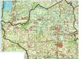 |
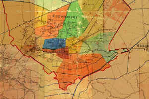
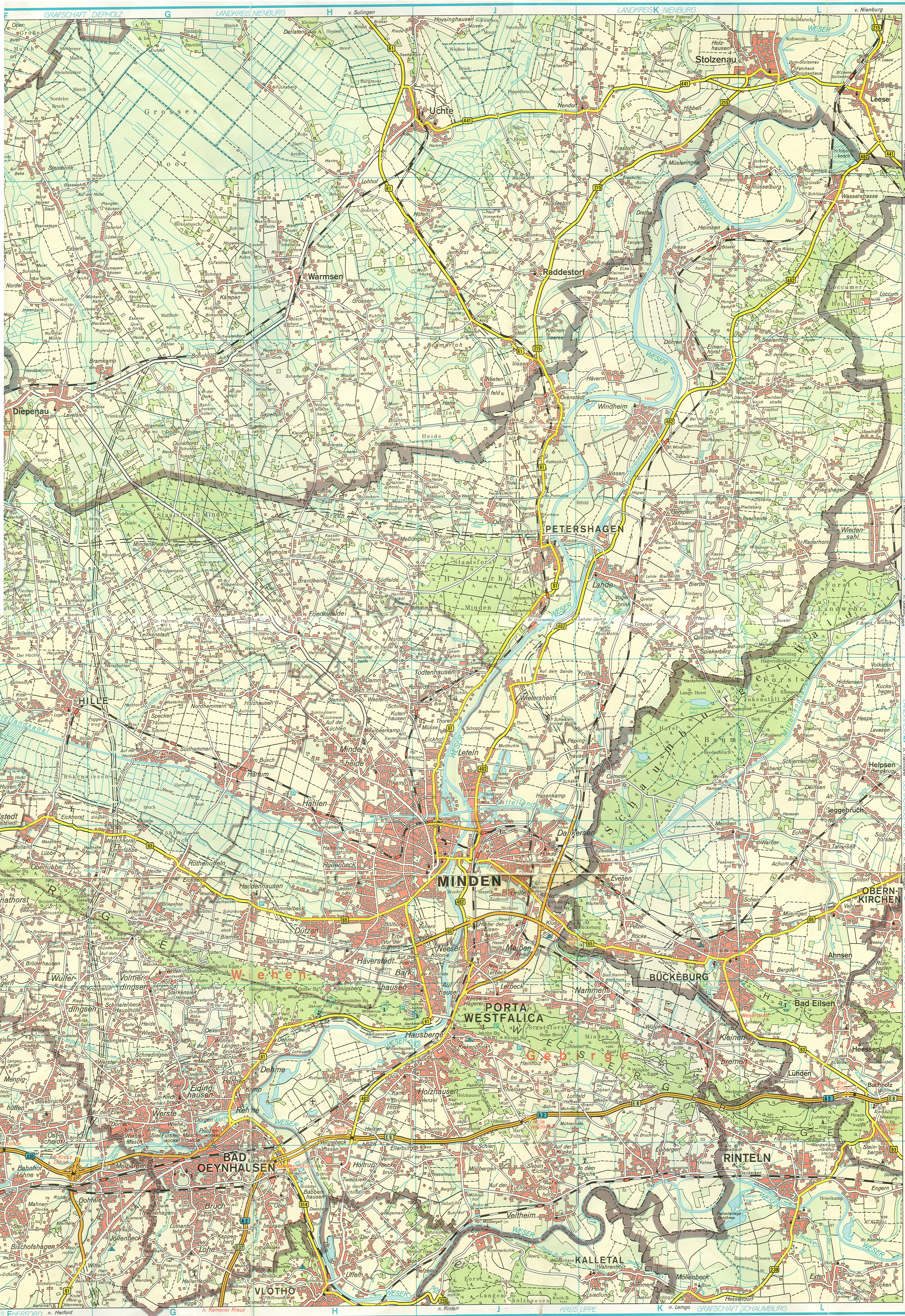
Kreiskarte Minden-Lübbecke (4.3MB). This is a map of the region of Minden-Lübbecke. This map is from . It is a high resolution scan of the map. The western portion of the area is in this image. The map shows not only the 3 parishes in Stemwede, but also includes Lemförde, Rahden, Wehe, Preußisch Ströhen, Espelkamp (including Gestringen, Fabbenstedt, Fiestel and part of Hedem), Frotheim and Isenstedt. It shows many of the small areas within the villages are referenced in church records like Bulzendorf, Mesenkamp, Jugendheim, Hegerfelderort and many others. Some of these reference points aren't included in the map above from 1988. Eastern Section of this map. (14 MB) |
|||||
 |
Kirchenkreis Minden (Church
District of Minden) from 1930. This is an area east of what's now
Stemwede. The map shows the church parishes in the district at that
time. In 1930 the parishes of Levern, Wehdem & Dielingen were
part of the Kirchenkreis Lübbecke (Church District of Lübbecke). Today
they are joined together as a single district. Click on the map to
enlarge it.
|
|||||
 |
Oppenwehe Historical Maps - Hosted at the Oppenwehe Website. This map is broken into the old neighborhoods of Oppenwehe and show the old homestead numbers and family name associated with each one. | |||||
 Minden-Lübbecke
Shield
Minden-Lübbecke
Shield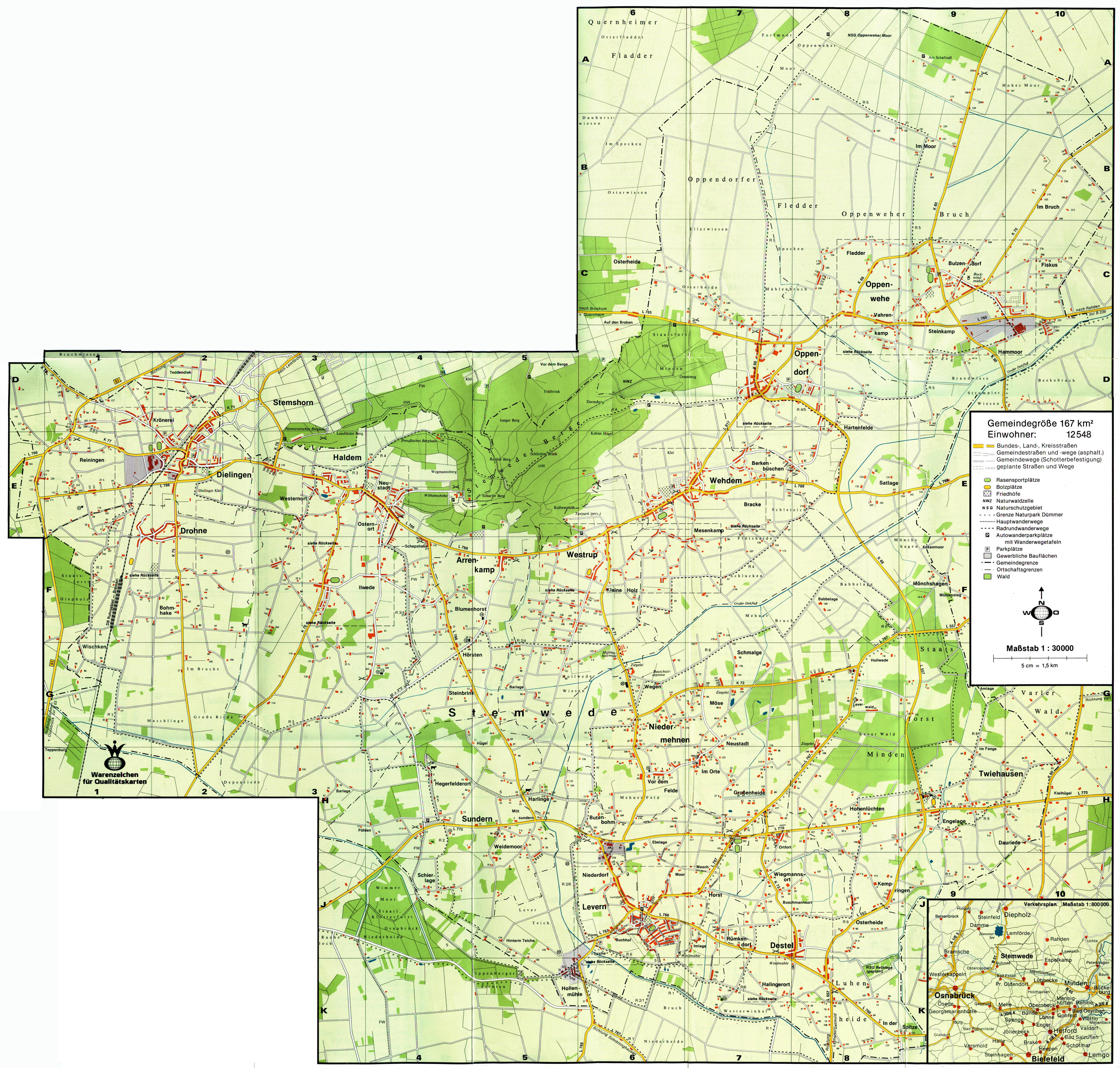